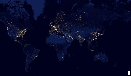
NASA and NOAA Giant create an interactive map Earth at Night that lets users explore flickered night lights on Planet. This earth view is assembled from data acquired by the Suomi NPP satellite. Google Maps lets users explore the earth at sun sets.
Now users explore Earth’s lands filled with lights using imagery from NASA and the National Oceanic and Atmospheric Administration’s “Black Marble.”
“It took 312 orbits to get a clear shot of every parcel of Earth’s land surface and islands,” Google wrote in its description of Earth at Night. “This new data was then mapped over existing Blue Marble imagery of Earth to provide a realistic view of the planet.”
NASA, 312 orbits and NOAA’s project required an extremely powerful Visible Infrared Imaging Radiometer Suite sensor to capture 2.5 terabytes of pictures.
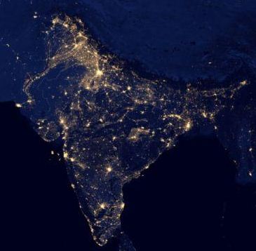
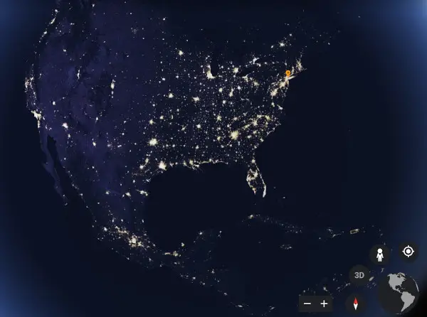
In this new Google’s map, users can search from country to country to see what different countries look like on the Black Marble. Imagery can also show you street names. Countries look beautiful at night view with light spreading over.
You can explore Google Earth to view how Earth looks at night. Or visit NASA’s Black Marble to know more.
Related:
- NASA Streams Cat Video from Space: Testing the Limits of Laser Communication
- Mark Your Calendars: The Great North American Eclipse Arrives in April 2024!
Comments